M
Birth 05/12/1852 🏛️ Irish Potato Famine | Ashton, Cheshire 📍 ⓘ1881 Census 1939 NHS Register Birth Civil Registration Index |
Marriage (27) 1879 | Martha LEE Chester, Cheshire 📍 ⓘCheshire BMD |
Lived (29) 1881 | 73 High Street, Over, Northwich, Cheshire 📍 ⓘ1881 Census 📎 Census |
Occupation (29) 1881 | Dairyman ⓘ1881 Census |
Lived (39) 1891 🏛️ Free elementary education | Farm House, Black-A-Tree Gate Road, Stockingford, Nuneaton, Warwickshire 📍 ⓘ1891 Census 📎 Census |
Occupation (39) 1891 | Farmer ⓘ1891 Census |
Death (91) 22/02/1943 🏛️ Second World War | Bunbury, Tarporley, Cheshire 📍 ⓘDeath Civil Registration Index Tim Mellor |
Children with Martha LEE
M
b. 1880, 73 High Street, Over, Northwich, Cheshire · d. 1952, Westhome Farm, Chester Road, Winsford, Cheshire · m. 1927 Annie SYMMS
F
b. 1881, 73 High Street, Over, Northwich, Cheshire · d. 1967, Bunbury, Tarporley, Cheshire
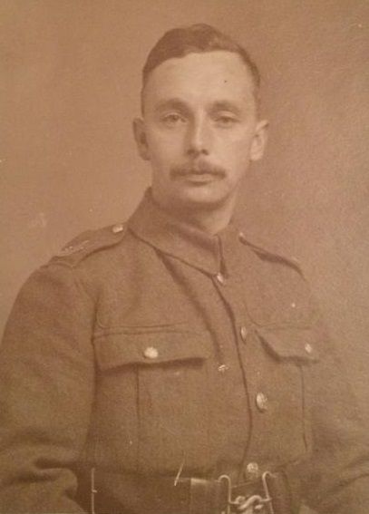
b. 1883, 73 High Street, Over, Northwich, Cheshire · d. 1917, Koksijde, Arrondissement Veurne, Flanders, Belgium · m. 1908 Lily DALE
M
b. 1884, 73 High Street, Over, Northwich, Cheshire · d. 1971, Oakdene, Hetherson Green, Bickley, Malpas, Cheshire · m. 1919 Lillian W PERRY
M
b. 1887, Farm House, Black-A-Tree Gate Road, Stockingford, Nuneaton, Warwickshire · d. 1963, Glossop, Derbyshire · m. 1924 Lily DALE
F
b. 1888, Farm House, Black-A-Tree Gate Road, Stockingford, Nuneaton, Warwickshire · d. 1964, Northwich, Cheshire
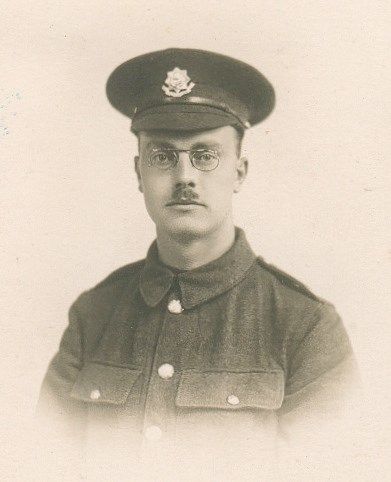
b. 1890, Farm House, Black-A-Tree Gate Road, Stockingford, Nuneaton, Warwickshire · d. 1917, Somme, Somme, France
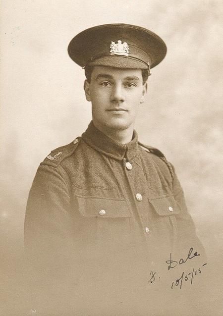
b. 1892, Farm House, Black-A-Tree Gate Road, Stockingford, Nuneaton, Warwickshire · d. 1917, Koksijde, Arrondissement Veurne, Flanders, Belgium
F
b. 1893, Farm House, Black-A-Tree Gate Road, Stockingford, Nuneaton, Warwickshire · d. 1976, Somerdale, Chester Road, Kelsall, Cheshire · m. 1923 Alfred BARKER
M
b. 1896, Farm House, Black-A-Tree Gate Road, Stockingford, Nuneaton, Warwickshire · d. 1970, Newton Abbot, Devon · m. 1922 Marie Calderbank CORBETT

📍 Location pins are approximate. Historic place names, boundary changes, and demolished buildings mean that some pins may point to a general area rather than the exact spot. County names reflect the historic county at the time of the event, not modern administrative boundaries.
Please respect this research. This information represents over twenty-five years of careful research and correspondence with family members. You are welcome to use it for personal genealogical research, but please do not reproduce, republish, or redistribute the content, photographs, or documents without permission. About this site →